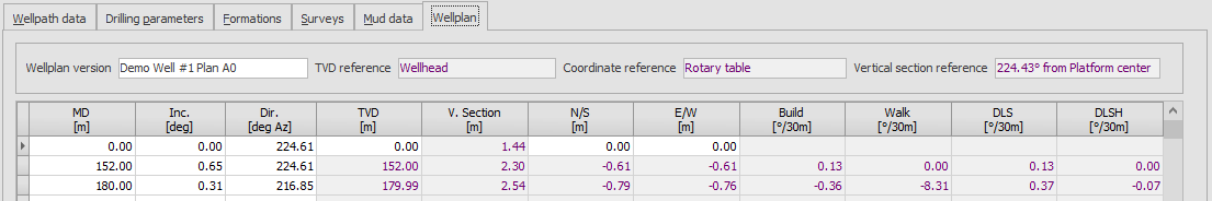
Similar to survey data, a planned trajectory for the wellpath may be entered on the Wellplan tab. The wellplan is used for some calculations, such as Planned MD from a Planned TVD for a casing setting depth.
It is not required to input interpolated surveys stations (e.g. every 30m or 100ft); only the so-called ‘critical points’ (kick off point, start of build, end of turn, etc) need to be entered. Where required WellRep will interpolate the required survey stations or depths.
For the first line of the wellplan (tie-on point), the TVD, N/S and N/S must be input manually. These value should be provided in accordance with the displayed TVD Reference and Coordinate Reference. If the references are changed, the tie-on data must be updated manually.
For a quick view of the planned trajectory or to compare the actual well trajectory (surveys) against the wellplan, a well plot is available.
 Wellrep is not designed to replace built-for-purpose wellplanning and surveying software like Landmark Compass etc. Data is recorded for reference only and calculation of (interpolated) MD's and TVD's only. For formal calculation of wellplan and survey data (and resulting well placement) do not use WellRep. For reference the Wellplan Version field was added in version 2.5.1.
|
Copyright © 2023 Softdrill NL |